DJI Matrice 4E (M4E) Enterprise Mapping Drone with RC Plus 2 Controller

$5,189.00

4/3 mechanical-shutter camera, 48 MP zoom, RTK and laser rangefinder in a 1.2 kg mapping drone.
  In Stock - Ready to Ship
Free shipping over $399
Money Back Guarantee

Talk to a Drone Nerds expert

Real pilots, Mon-Fri 9-6 ET.    Questions, pricing, fleet quotes.

Drone Nerds Recommended Bundle

Recommended kit

What our experts add to this order.

  • DJI Matrice 4E (M4E) Enterprise...$5,189.00
  • DJI Matrice 4 Series Battery$245.00
  • DJI Matrice 4 Series Propellers$29.00
3 items $5,463.00
Add all to cart

Untick anything you already own. Total updates as you go.

DJI Enterprise · Matrice 4 Series

Matrice 4E The mapping flagship, in a 1.2 kg airframe.

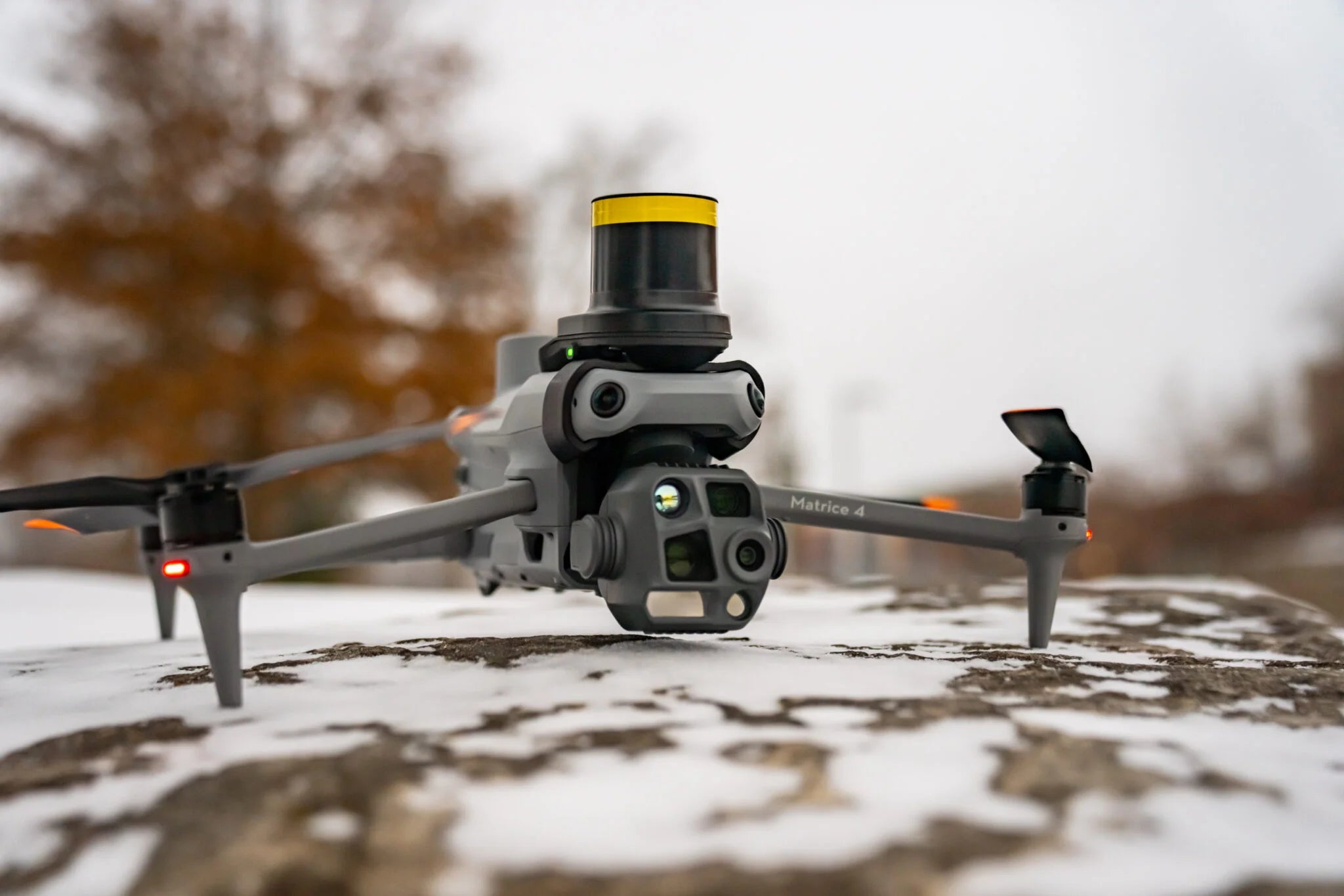
A 20 MP 4/3 mechanical-shutter camera, 48 MP medium tele and telephoto, a 1,800 m laser rangefinder and integrated RTK, in a drone that launches in 15 seconds and maps 2.8 km² in a single flight. The Matrice 4E is DJI's answer to the surveyor who wants Mavic-size logistics with Phantom 4 RTK results.

49minMax flight time
2.8km²Mapped per flight
20MP4/3 CMOS, mechanical shutter
1800mLaser rangefinder

Four instruments.
One gimbal.

The wide camera is the mapping engine: a 4/3 sensor with a true mechanical shutter. The tele cameras and rangefinder are the same as the 4T.

  • Wide · mapping
    24mm
    20 MP · 4/3 CMOS · f/2.8–f/11 · mechanical shutter
  • Medium tele
    70mm
    48 MP · 1/1.3" CMOS · f/2.8
  • Tele
    168mm
    48 MP · 1/1.5" CMOS · f/2.8
  • Laser rangefinder
    1800m
    ±(0.2 + 0.0015×D) m · 1 m blind zone
DJI Matrice 4E gimbal with 4/3 mechanical-shutter wide camera, medium tele, telephoto and laser rangefinder

Survey the site.
Then inspect it.

Map with the wide camera, then zoom to 168 mm to check a crack, a bolt or a gauge without landing to swap payloads.

  1. 24mm

    Mapping and oblique capture

    Mechanical shutter kills rolling-shutter distortion at 21 m/s, so orthos and models come out clean.

  2. 70mm

    Medium range inspection

    Resolve bolts, cracks and gauge readings from 10 m on power lines, bridges and substations.

  3. 168mm

    Super resolution telephoto

    48 MP at 7x optical equivalent with foreground stabilization at 10x and above. Signage legible at 250 m.

Mapping that holds up
to a total station.

Mechanical shutter, integrated RTK and new capture modes built for DJI Terra. Fewer flights, fewer GCPs, cleaner deliverables.

  • Mechanical

    Global-style shutter

    No rolling-shutter smear on the 4/3 wide camera, even mapping at full speed.

  • 0.5 s

    Photo interval

    Faster capture means higher mapping speed and more coverage per battery.

  • 3-direction

    Ortho capture

    Lateral capture during ortho missions. Less overlap needed, better elevation accuracy, no extra pass.

  • 5-direction

    Oblique capture

    The gimbal rotates through five angles in one pass for Smart 3D Capture models.

  • RTK + L5

    Centimeter positioning

    Integrated module, extended L5 band. Network RTK or pair with D-RTK 3 for a base.

Built for the jobs
that get measured.

From a 10-acre pad to a 2.8 km² corridor, the 4E replaces a Phantom 4 RTK and a Mavic 3E with one case.

  • Surveyor flying the DJI Matrice 4E with RC Plus 2 and D-RTK 3 base station

    Surveying and mapping

    RTK-tagged, mechanical-shutter imagery straight into Terra, Pix4D or Metashape. Check points instead of GCP grids.

    TopoBoundaryCorridor
  • DJI Matrice 4E mapping an active construction site

    Construction

    Weekly progress orthos and cut/fill in under an hour of flying. Oblique sets for as-built models.

    ProgressCut / fillAs-built
  • DJI Matrice 4E surveying a quarry for stockpile volumetrics

    Mining and aggregates

    Stockpile volumetrics with repeatable accuracy. Fly the pit on a schedule, compare surfaces month to month.

    VolumetricsHighwallHaul roads
  • DJI Matrice 4E inspecting infrastructure with telephoto zoom

    Infrastructure

    Map the asset, then switch to 168 mm and document defects in the same flight. One dataset, two deliverables.

    BridgesDamsRail

Flies itself home
when the signal doesn't.

Integrated RTK, omnidirectional vision and O4 Enterprise transmission. The safety stack usually reserved for drones twice this size.

DJI Matrice 4E flying with O4 Enterprise transmission over open terrain
  • 25km

    O4 Enterprise transmission

    Eight aircraft antennas plus the RC Plus 2's high-gain array. 20 MB/s download, more than double Mavic 3 Enterprise.

  • 15s

    Takeoff with fusion positioning

    GNSS + Vision Fusion sets the home point visually and keeps return-to-home working even without GNSS.

  • L5

    Integrated RTK

    Extended L5 band for centimeter-level positioning in urban canyons and under canopy.

  • 21m/s

    Obstacle sensing at speed

    Omnidirectional vision stays active up to max horizontal speed. Terrain-aware routing when the RC is online.

  • 12m/s

    Wind and weather

    IP55 rated and stable in winds up to 12 m/s at takeoff and landing. -20° to 50°C operating range.

4E or 4T?

Same airframe, same tele and medium-tele cameras, same rangefinder. The difference is the fourth sensor and what the wide camera is built for.

Spec Matrice 4E Matrice 4T →
Primary mission Surveying, mapping, construction, mining Thermal, SAR, public safety, inspection
Wide camera 4/3 20 MP, f/2.8–f/11, 24 mm, mechanical shutter 1/1.3" 48 MP, f/1.7, 24 mm
Thermal camera None 640 × 512, f/1.0, High-Res mode
NIR auxiliary light None 100 m, 6° FOV
Medium tele and tele 70 mm and 168 mm, 48 MP 70 mm and 168 mm, 48 MP
Laser rangefinder 1,800 m 1,800 m
Min photo interval 0.5 s 0.7 s
Ortho capture 3-direction ortho, 2.8 km² per flight Standard

Rule of thumb: if your deliverable is an orthomosaic, point cloud or volume, it's the 4E. If you ever need to see heat or operate at night, the 4T earns its premium.

Full specifications

Measured by DJI in windless conditions. Real-world flight time depends on payload, wind, temperature and flight mode.

Aircraft
Takeoff weight1,219 g
Max takeoff weight1,430 g
Max horizontal speed21 m/s
Max flight time49 min (std props)
Max hover time42 min
Max flight distance35 km
Max wind resistance12 m/s
Max service ceiling6,000 m
Operating temperature-20° to 50°C
Ingress protectionIP55
Sensing and positioning
Vision systemOmnidirectional
Obstacle sensing speed≤ 21 m/s
RTKIntegrated, L5 band
PositioningGNSS + Vision fusion
RTH without GNSSSupported
Time to takeoff15 s
Terrain-aware routingVia RC Plus 2
Onboard AIVehicle, vessel, person
Transmission and imaging
Video transmissionO4 Enterprise
Max range (FCC)25 km
Aircraft antennas8
Download bandwidth20 MB/s
Remote controllerDJI RC Plus 2 Enterprise
Wide camera4/3 20 MP, mech. shutter
Max photo size5280 × 3956 (wide)
Min photo interval0.5 s
SKUCP.EN.00000574.01

In the box

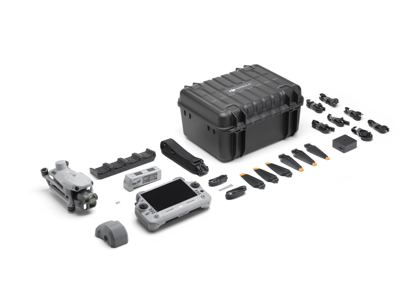
Standard combo with DJI RC Plus 2 Enterprise. One battery is included; survey crews usually run three plus a D-RTK 3.

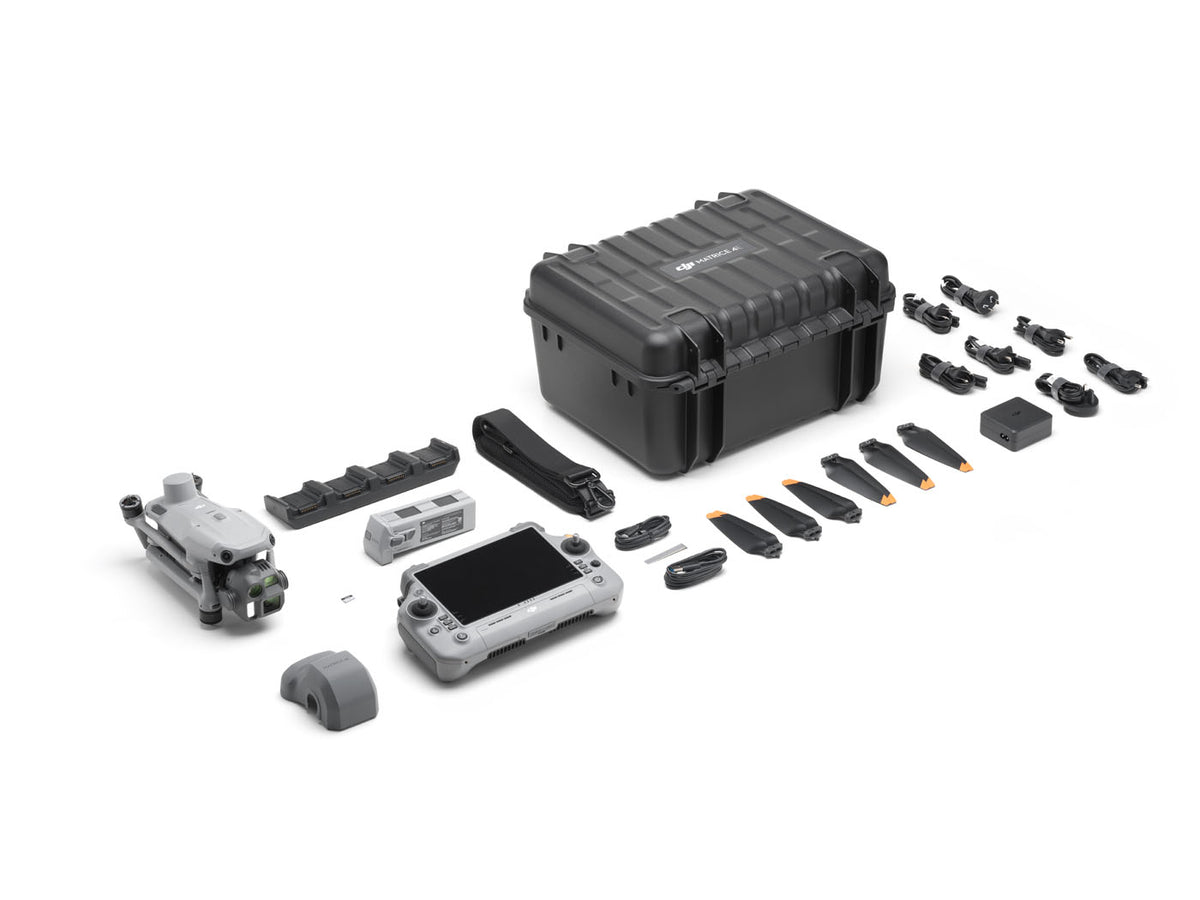
DJI Matrice 4E combo contents: aircraft, RC Plus 2 Enterprise, battery, charging hub, propellers and storage case
  • DJI Matrice 4E aircraft×1
  • DJI RC Plus 2 Enterprise×1
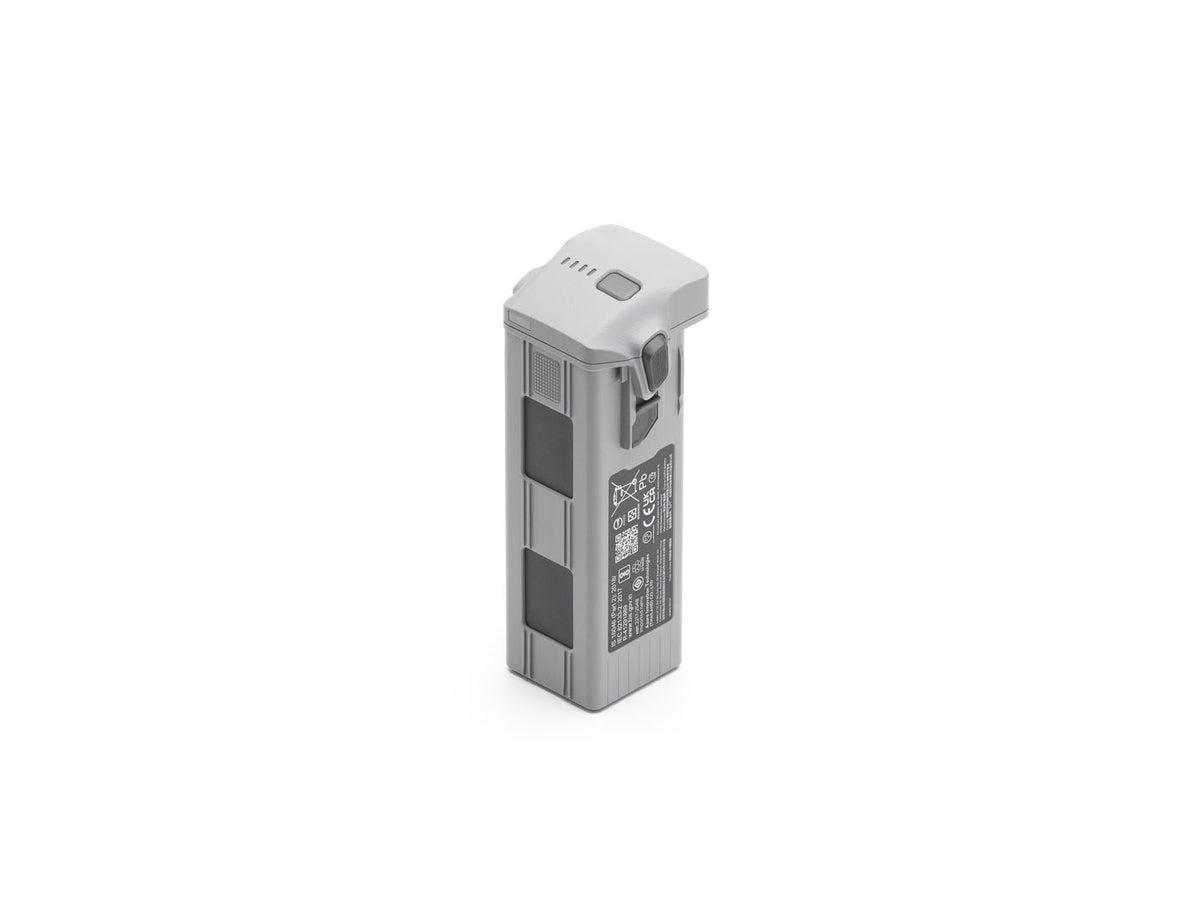
  • Matrice 4 Series Battery×1
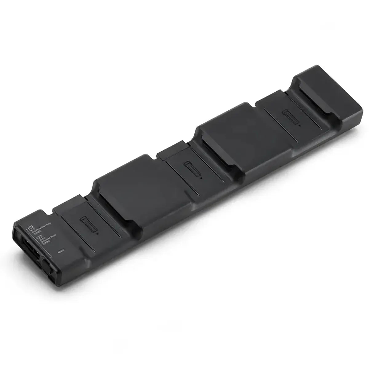
  • Matrice 4 Series Charging Hub×1
  • 100 W USB-C Power Adapter + AC cable×1
  • Matrice 4 Series Propellers (pairs)×3
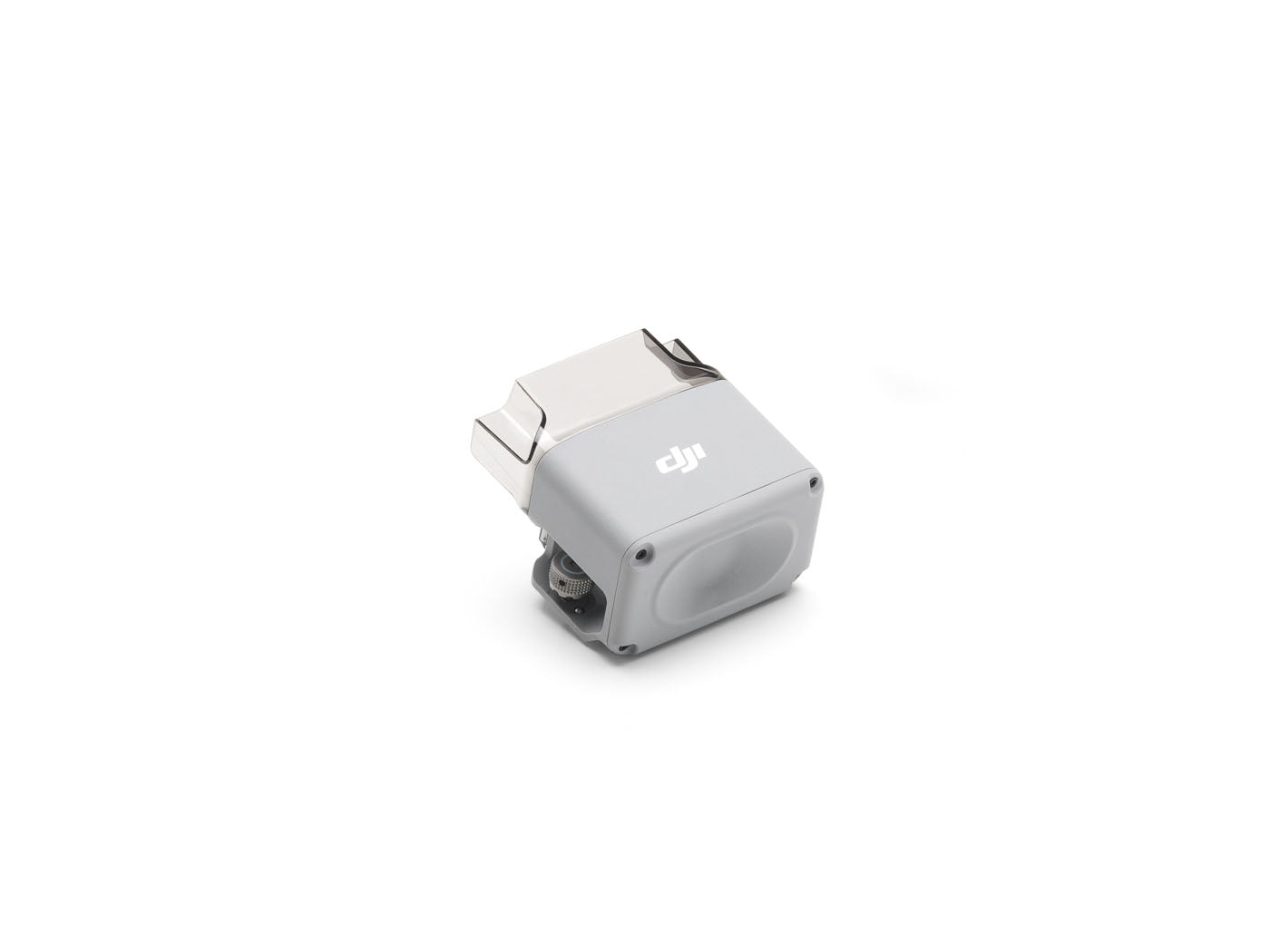
  • Matrice 4E Gimbal Protector×1
  • microSD Card×1
  • USB-C to USB-C Data Cable×1
  • USB-A to USB-C Data Cable×1
  • Cellular Dongle 2 Pry Bar×1
  • Storage Case + Shoulder Strap×1

Build the kit
around it.

What our enterprise team adds to nearly every 4E order, and the accessories that turn it into a complete survey kit.

  • DJI Matrice 4 Series Intelligent Flight Battery
    Must-have

    Matrice 4 Series Intelligent Flight Battery

    Combo ships with one. Three keeps an aircraft airborne continuously with the hub.

    Shop battery
  • DJI Matrice 4 Series Charging Hub
    Must-have

    Matrice 4 Series Charging Hub (200 W)

    Sequential charging for up to four batteries plus the RC Plus 2. Fast turnaround between sorties.

    Shop charging hub
  • DJI AS1 Speaker for Matrice 4 Series
    Payload

    DJI AS1 Speaker

    Live voice and recorded messages from the top accessory port. SAR, crowd ops, evacuation.

    Shop AS1
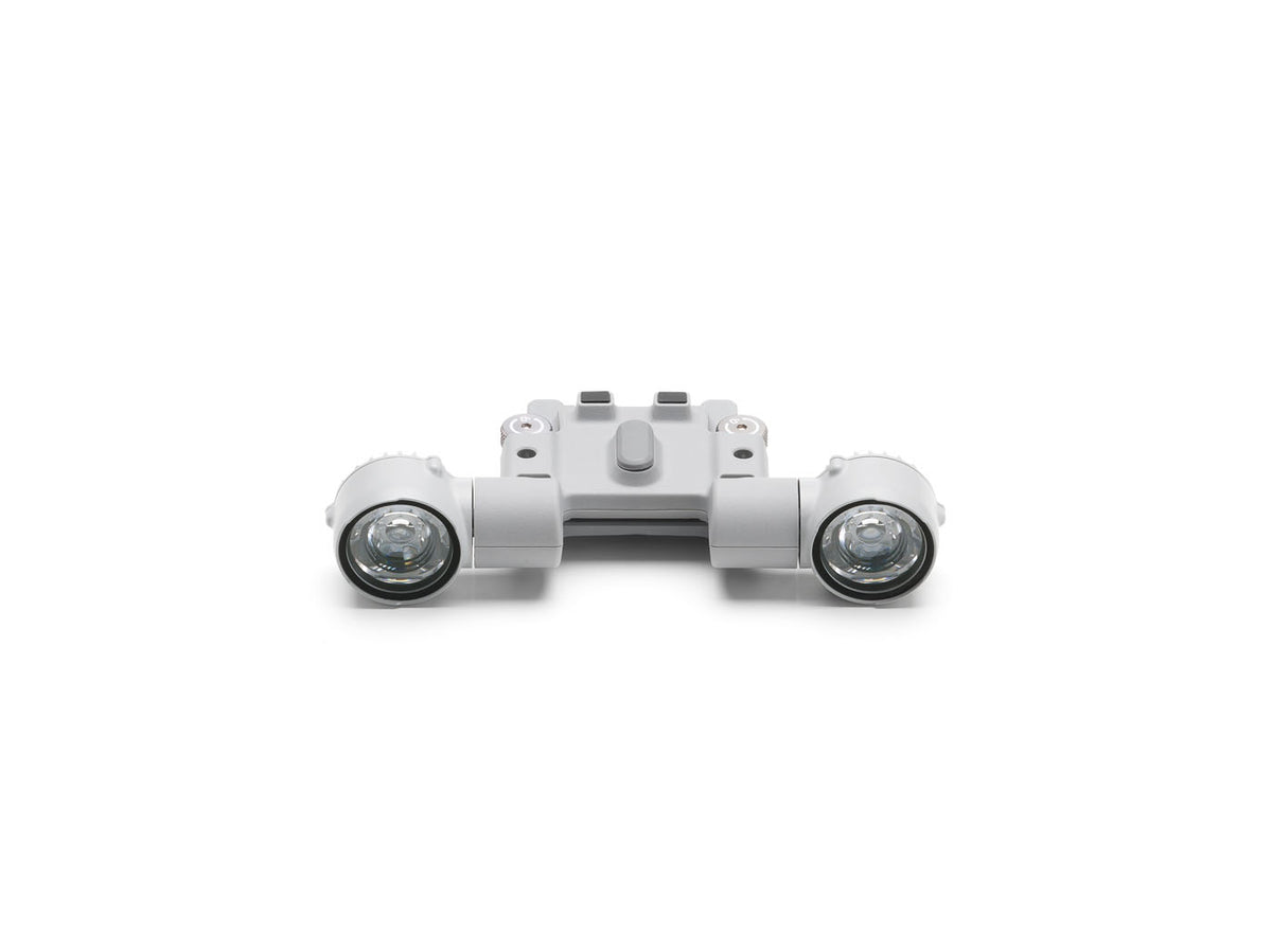
  • DJI AL1 Spotlight for Matrice 4 Series
    Payload

    DJI AL1 Spotlight

    Visible-light spotlight for night landing zones, searches and scene illumination.

    Shop AL1
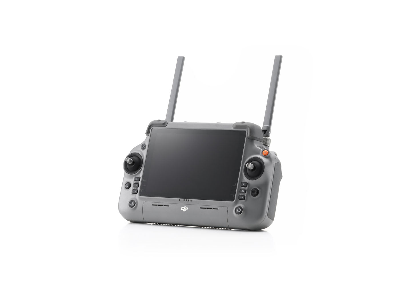
  • DJI RC Plus 2 Enterprise remote controller
    Controller

    DJI RC Plus 2 Enterprise

    7-inch 1400-nit display, IP54, hot-swap batteries. Included in the combo; spare for a second operator.

    Shop RC Plus 2
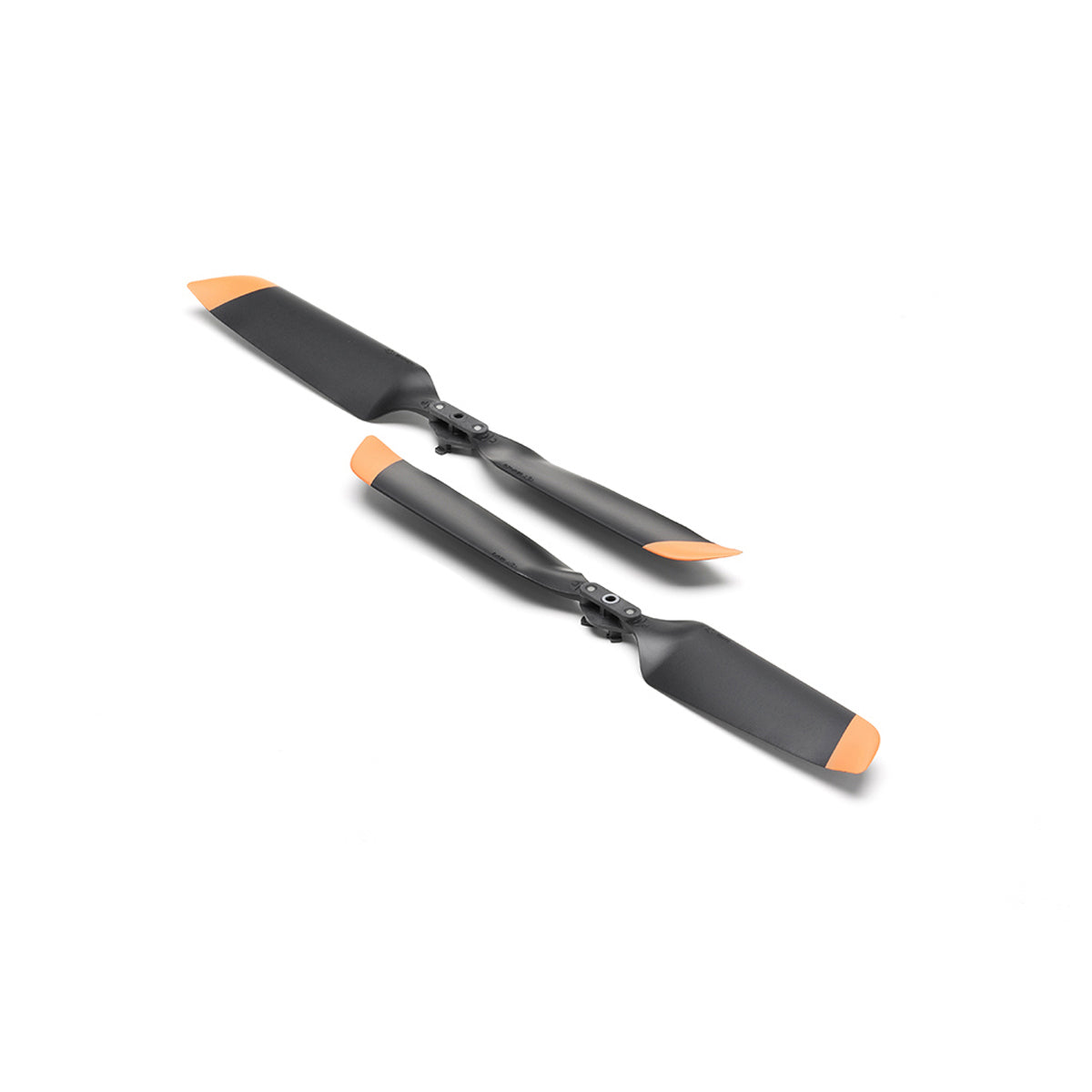
  • DJI Matrice 4 Series propellers
    Spares

    Matrice 4 Series Propellers

    Low-noise props, sold in pairs. Keep a full set in the case; a chipped blade grounds the aircraft.

    Shop propellers
  • AVSS PRS-M4SUS parachute recovery system for DJI Matrice 4 Series
    Safety

    AVSS PRS-M4SUS Parachute

    FAA-accepted recovery system for flight over people. Includes EM pod, bracket, FTS and rugged case.

    Shop parachutes
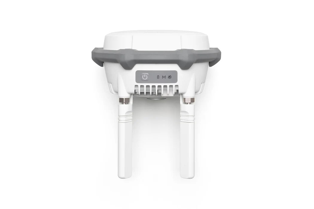
  • DJI D-RTK 3 Multifunctional Station
    Must-have for survey

    D-RTK 3 Multifunctional Station

    Your own base station: centimeter corrections on sites with no network RTK, and PPK-ready logs.

    Shop D-RTK 3

Capture to report
without the USB stick.

The 4E plugs into DJI's enterprise software stack and exports to the photogrammetry tools you already run. Plan, fly, process, deliver.

  1. Plan and fly

    DJI Pilot 2

    Runs on the RC Plus 2. Mission planning, live thermal tools, AI detection, and cruise control.

    • Waypoint, mapping and oblique missions
    • 3-direction ortho, 5-direction oblique
    • Smart track and pin-point share
  2. Stream and coordinate

    DJI FlightHub 2

    Cloud ops center. Live video to command staff, shared annotations, fleet and pilot management.

    • Live stream over O4 Enterprise
    • Cloud mapping in minutes
    • On-premises edition available
  3. Model and measure

    DJI Terra

    Built for the 4E's 3-direction ortho and Smart 3D Capture. 2D orthos, 3D meshes, point clouds, volumes.

    • Ortho and oblique reconstruction
    • Stockpile and cut/fill volumes
    • Exports to Pix4D, Metashape, CAD, GIS
  4. Integrate

    Cloud API and SDKs

    Push data into your own systems. Evidence management, GIS, asset databases.

    • Cloud API for third-party platforms
    • Mobile SDK for custom apps
    • Local data mode, no cloud sync
DJI Terra 3D reconstruction from Matrice 4E imagery

Questions we get
every day.

Straight answers from the team that sells, flies and services Matrice aircraft every day.

Matrice 4E vs Mavic 3 Enterprise, what actually changed?

Same 20 MP 4/3 mechanical-shutter wide camera class, but the 4E adds a 70 mm medium tele, a 48 MP telephoto (vs 12 MP), a laser rangefinder, integrated RTK (no module to buy), IP55 sealing, 3-direction ortho and O4 Enterprise with double the bandwidth. If you're buying new for mapping, the 4E is the better tool.

Do I still need ground control points?

With network RTK or a D-RTK 3 base and a good fix, most crews move to a handful of check points instead of a full GCP grid. For survey-grade deliverables you still verify against independent checks; the 4E just makes that a smaller job.

What's the real-world flight time?

DJI's 49 minutes is a no-wind lab number. Plan on 35 to 40 minutes of mission time with a landing reserve, less in wind. Three batteries and the hub keep one aircraft mapping continuously.

Does it work with Pix4D, Metashape or my GIS?

Yes. Imagery carries RTK-corrected geotags in EXIF, and DJI Terra exports standard formats (GeoTIFF, LAS, OBJ, PLY, DXF). You are not locked into Terra.

Can the 4E do inspection work too?

Yes. The 70 mm and 168 mm cameras are identical to the 4T's, so you can map a site and then zoom in on defects in the same flight. What it lacks is thermal; for that, see the 4T.

What do I need to fly it commercially in the US?

An FAA Part 107 remote pilot certificate, aircraft registration, and Remote ID (built in). We can help with both the certificate path and agency COAs.

Bought from the people
who fix them.

Drone Nerds is an authorized DJI Enterprise dealer with a DJI Enterprise Authorized Service Center in South Florida. When your 4E is a tool and not a toy, where you buy it is part of the spec.

  • Authorized DJI Enterprise dealer

    Factory-new US stock, full DJI warranty, Care Enterprise options at checkout.

  • DJI Enterprise Authorized Service Center

    Repairs, calibration and warranty work by our certified techs in South Florida.

  • Enterprise financing and government purchasing

    Agency POs, Approve financing, and multi-unit pricing for departments and fleets.

  • Setup, training and support

    Our team flies these daily. Call 786-708-7807 and reach someone who has.

Drone Nerds headquarters and DJI Enterprise Authorized Service Center in South Florida
SHORT DESCRIPTION
4/3 mechanical-shutter camera, 48 MP zoom, RTK and laser rangefinder in a 1.2 kg mapping drone.
SKU
CP.EN.00000574.01
Manufacturer
DJI
UPC
190021123052
compatible with
DJI Matrice 4

Questions we get
every day.

Straight answers from the team that sells, flies and services Matrice aircraft every day.

Matrice 4E vs Mavic 3 Enterprise, what actually changed?

Same 20 MP 4/3 mechanical-shutter wide camera class, but the 4E adds a 70 mm medium tele, a 48 MP telephoto (vs 12 MP), a laser rangefinder, integrated RTK (no module to buy), IP55 sealing, 3-direction ortho and O4 Enterprise with double the bandwidth. If you're buying new for mapping, the 4E is the better tool.

Do I still need ground control points?

With network RTK or a D-RTK 3 base and a good fix, most crews move to a handful of check points instead of a full GCP grid. For survey-grade deliverables you still verify against independent checks; the 4E just makes that a smaller job.

What's the real-world flight time?

DJI's 49 minutes is a no-wind lab number. Plan on 35 to 40 minutes of mission time with a landing reserve, less in wind. Three batteries and the hub keep one aircraft mapping continuously.

Does it work with Pix4D, Metashape or my GIS?

Yes. Imagery carries RTK-corrected geotags in EXIF, and DJI Terra exports standard formats (GeoTIFF, LAS, OBJ, PLY, DXF). You are not locked into Terra.

Can the 4E do inspection work too?

Yes. The 70 mm and 168 mm cameras are identical to the 4T's, so you can map a site and then zoom in on defects in the same flight. What it lacks is thermal; for that, see the 4T.

What do I need to fly it commercially in the US?

An FAA Part 107 remote pilot certificate, aircraft registration, and Remote ID (built in). We can help with both the certificate path and agency COAs.

In the box

Standard combo with DJI RC Plus 2 Enterprise. One battery is included; survey crews usually run three plus a D-RTK 3.

DJI Matrice 4E combo contents: aircraft, RC Plus 2 Enterprise, battery, charging hub, propellers and storage case
  • DJI Matrice 4E aircraft×1
  • DJI RC Plus 2 Enterprise×1
  • Matrice 4 Series Battery×1
  • Matrice 4 Series Charging Hub×1
  • 100 W USB-C Power Adapter + AC cable×1
  • Matrice 4 Series Propellers (pairs)×3
  • Matrice 4E Gimbal Protector×1
  • microSD Card×1
  • USB-C to USB-C Data Cable×1
  • USB-A to USB-C Data Cable×1
  • Cellular Dongle 2 Pry Bar×1
  • Storage Case + Shoulder Strap×1