
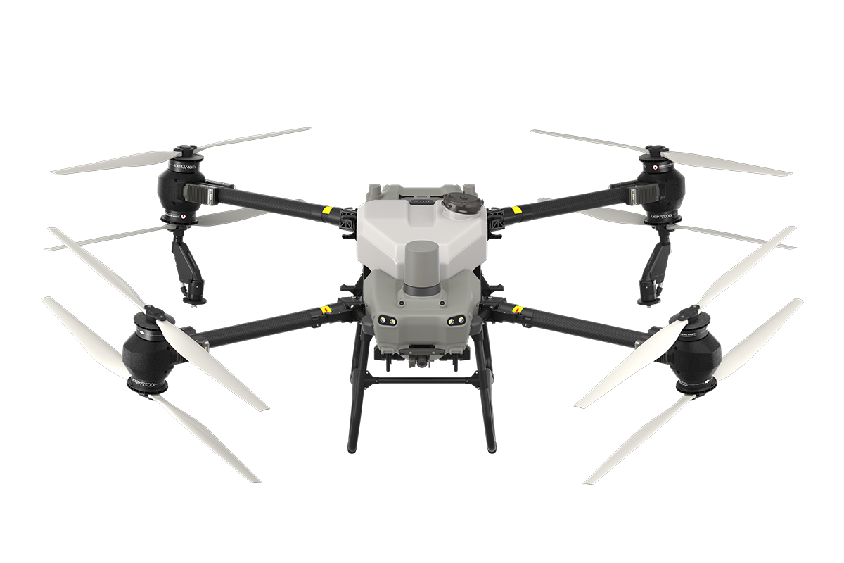


DJI Agras T50
Precision Agricultural Drone
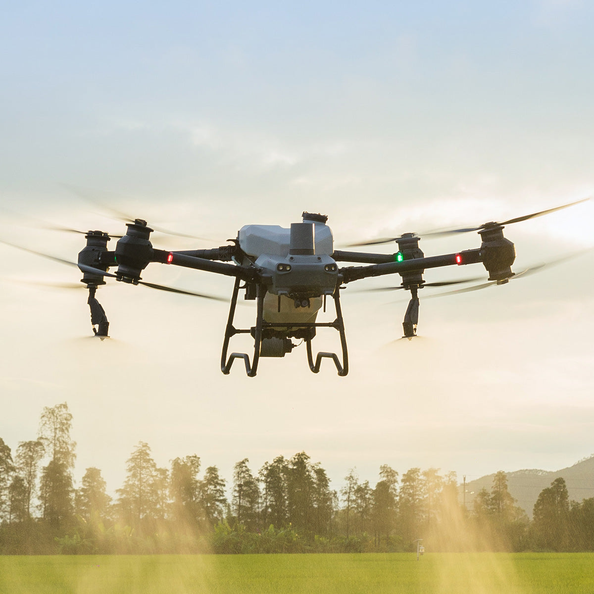
DJI AGRAS T50 elevates drone agricultural operations to new heights. It inherits a powerful coaxial twin-rotor propulsion system and a split-type torque resistant structure for next level stability when carrying 40 kg spraying or 50 kg spreading payloads.
DJI AGRAS T50 leverages a Dual Atomizing Spraying System, Front and Rear Phased Array Radars, and a Binocular Vision System. DJI AGRAS T50 excels across multiple scenarios, from surveying to spraying and spreading, guaranteeing stable operations and steady performance.
Heavy Payload
High Flow Rate
Signal Stability
All Scenario Adaptability
Multidirectional Obstacle Sensing
Four Sprinkler Kit (Optional)
21 hectares per hour
1,500 kg of granules per hour
GET IN TOUCH WITH AN EXPERT
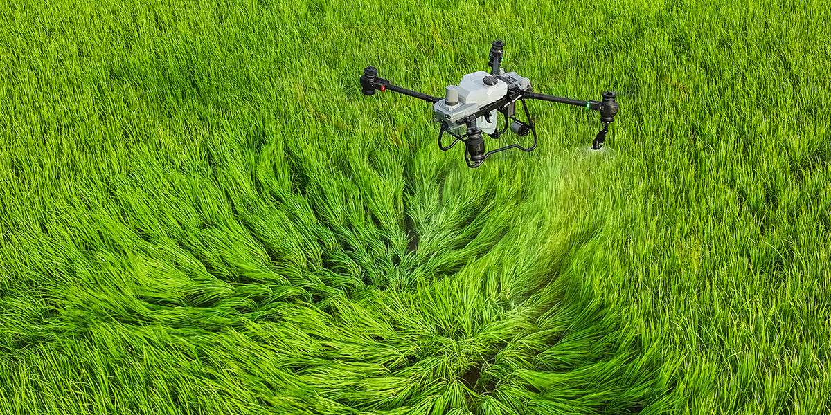
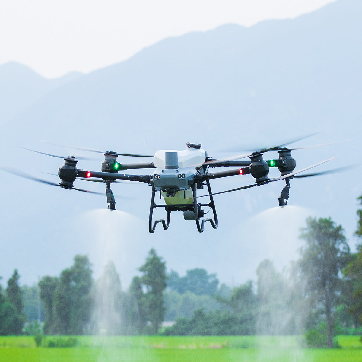
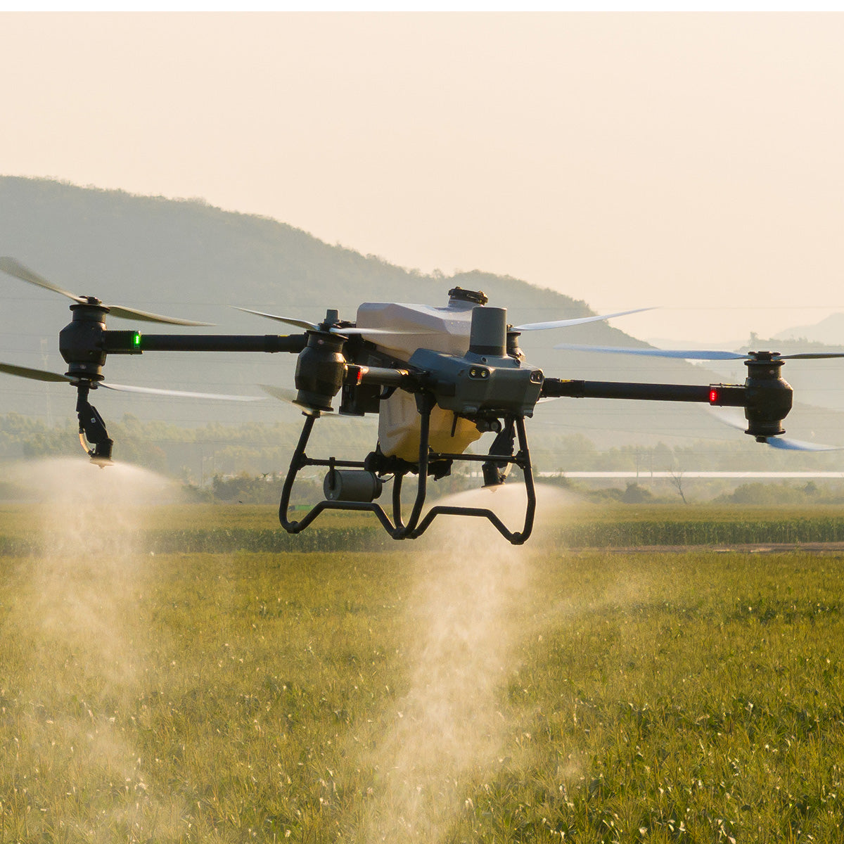
Spraying System
High Rate, Atomized Spray, Leak Free
DJI AGRAS T50's Dual Atomizing Spraying System provides an ultra-large flow rate of up to 16 L/min (2-sprinkler spraying). It produces uniform and fine spray droplets, and does not leak. The DJI AGRAS T50 can be equipped with an additional pair of centrifugal sprinklers, increasing flow rate to 24 L/min (4-sprinkler spraying) for operations that require high application volume. When flying manually, use Reverse Directional Spray with four sprinklers to simplify operations without having to make turns.
Magnetic Drive Impeller Pump
Dual pump flow rate of up to 24 L/min. This is a 100% increase compared with the previous generation, to meet demands of fields, orchards, and high-temperature environments.
Dual Atomized Centrifugal Sprinkler
Droplet size can be adjusted between 50-500 μm, depending on the chemicals used.
Brand-New Solenoid Valves
Precision starting and stopping eliminates leaking.
Double your peace of mind
with Binocular Vision and Dual Radar
DJI AGRAS T50 is equipped with front and rear Active Phased Array Radars with double the number of RF channels for higher detection precision. Together they enable Multidirectional Obstacle Sensing, elevating operating safety. Two sets of Binocular Vision sensors enable DJI AGRAS T50 to accurately sense terrain and depict obstacles in detail, for automatic obstacle bypassing and Terrain Following over steep slopes.
One drone for surveying, spraying, and spreading
DJI AGRAS T50 integrates aerial surveying, spraying, and spreading into a single drone. A high-resolution FPV gimbal camera enables real-time capture of field and orchard images. Paired with DJI RC Plus and RTK service, you can generate high definition maps which underpin subsequent automatic flight routes. DJI AGRAS T50 can take off and perform automatic operations, all at the push of a button.
Orchard Aerial Survey
DJI AGRAS T50 supports obstacle bypassing and Terrain Following for surveying of orchards on slopes up to 20°. With DJI RC Plus and its real-time mapping capabilities, it can automatically identify fruit trees and obstacles. Based on the distribution of the fruit trees, it can generate accurate and fully automatic 3D flight routes.
Signal Stability
The new and upgraded quad-antenna O3 Transmission system works offline even in areas without cellular coverage, offering a transmission range of 2 km. Its anti-interference ability helps ensure high signal quality during operations over tall crops.
Accessories
D12000iE Multifunctional Inverter Generator
30L tank charges 47 batteries | 1500W AC output | 9-min ultra-fast charging
DB1560 Intelligent Flight Battery
Capacity increased to 30 Ah.
Up to 1,500 charging cycles.
C10000 Intelligent Charger
9,000 W fast charging
Power-adaptive protection
1.5 m long charging cable
Smart Agriculture Ecosystem
Pair DJI AGRAS T50 with the new Mavic 3M and leverage multispectral data to minimize inputs and maximize yields. Survey your farm and generate prescription maps to guide variable rate fertilization and crop protection. Quickly patrol fields to identify growth stress.
GET IN TOUCH WITH AN EXPERT
Aircraft
Longest control range: 2,000 m;
Maximum flight speed 10 m/s, maximum operating flight speed 10 m/s
Dual Atomizing Spraying System
The droplet size can be customized or set to one of six droplet size levels: Very Coarse, Coarse, Medium, Fine, Very Fine, and Extremely Fine.
Active Phased Array Radar System + Binocular Vision System
2. Steep-slope Terrain Follow.
2. The light intensity must be moderate, the scenarios must have rich texture features, and the Binocular Vision System must be free of stains or obstructions.
3. Active Obstacle Bypassing is supported at an altitude of 2.5-8 m. Terrain Follow is supported at an altitude of 1.5-30 m.
4. Obstacle Bypassing is not recommended around electric or guy wires.
Surveying and Mapping
*To ensure a high success rate of surveying and mapping, DJI AGRAS T50 will automatically adjust its flight speed based on the hill slope. The steeper the slope, the slower its speed.
Boundary Route surveying: Surveys and maps the 20 m wide area around the field boundary. This mode is capable of quickly surveying large areas and is suitable for areas without obstacles.
Charging Device
Spreading System
Spreading system
2. With the spiral channel spinning disk, spreading is more uniform;
3. Capacity has been increased to 75 L.
DJI RC Plus
DJI Relay Module
2. Make sure that the DJI Relay is installed at least 2 meters higher than obstacles to ensure smooth signal transmission.
3. Do not use the DJI Relay during thunderstorms.
DJI Smart Farm Web
Crop growth monitoring: Observe crop growth through NDVI and other vegetation indices to identify seedling emergence, nutritional status, weed distribution, water stress, and other conditions, to improve field scouting efficiency.
Prescription Maps: Generate prescription maps for variable rate fertilization and crop protection based on crop growth monitoring results, ensuring even growth and reducing the application of chemicals.
Fruit tree counting: Automatically count fruit tree numbers.
Surveying and mapping of orchards and farmlands: Map operation areas and plan fully automatic routes for AGRAS drones.
Farmland surveying and mapping: Generate high-resolution maps where farmland boundaries are automatically extracted, allowing users to survey the cultivated area.
